The Altai Mountains are a 2,525 km mountain system stretching northwest to southeast across Russia, China, Mongolia, and Kazakhstan. Geologically, the range is built from granite and metamorphic schist bedrock, cut by major active fault zones, and shaped by ongoing tectonic forces — the Siberian Altai is the northernmost region still affected by the slow-motion collision of India into Asia. The highest summit, Belukha, reaches 4,506 m. The mountains are seismically alive: a magnitude 7.3 earthquake struck the Chuya Basin in 2003. This combination of hard crystalline rock, active faulting, and heavy glaciation is what gives the Altai its dramatic sharp-peaked landscape.
Key Takeaways
- The Altai range stretches 2,525 km across Russia, China, Mongolia, and Kazakhstan
- Belukha is the highest summit at 4,506 m (14,783 ft)
- Bedrock is mainly granite and metamorphic schist, heavily sheared near fault zones
- The range is tectonically active — linked to the distant India-Asia collision
- The Kurai and Tashanta fault zones run through the mountains and remain active
- A magnitude 7.3 earthquake struck the Chuya Basin in 2003
- The Irtysh and Ob rivers have their headwaters in the Altai
What Kind of Mountains the Altai Are
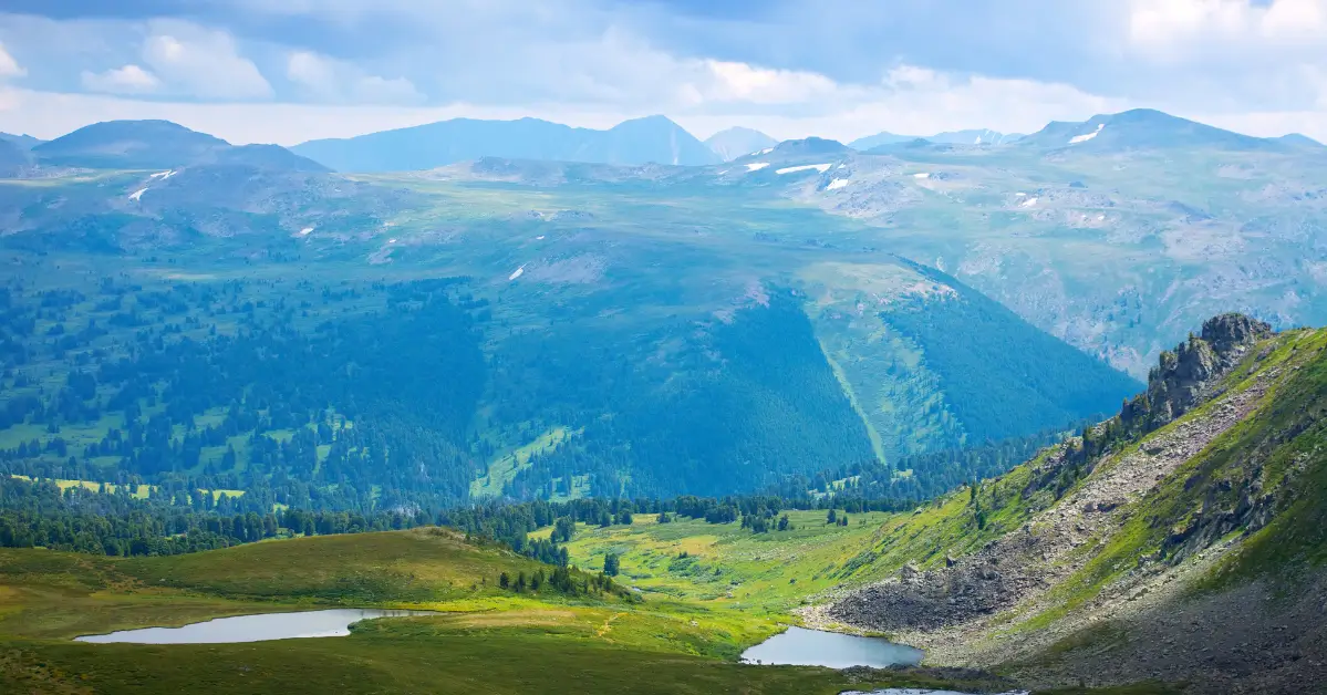
The Altai Mountains are one of the great mountain systems of Inner Asia. The range stretches for 2,525 km (1,569 miles) from northwest to southeast, crossing the borders of four countries — Russia, China, Mongolia, and Kazakhstan.
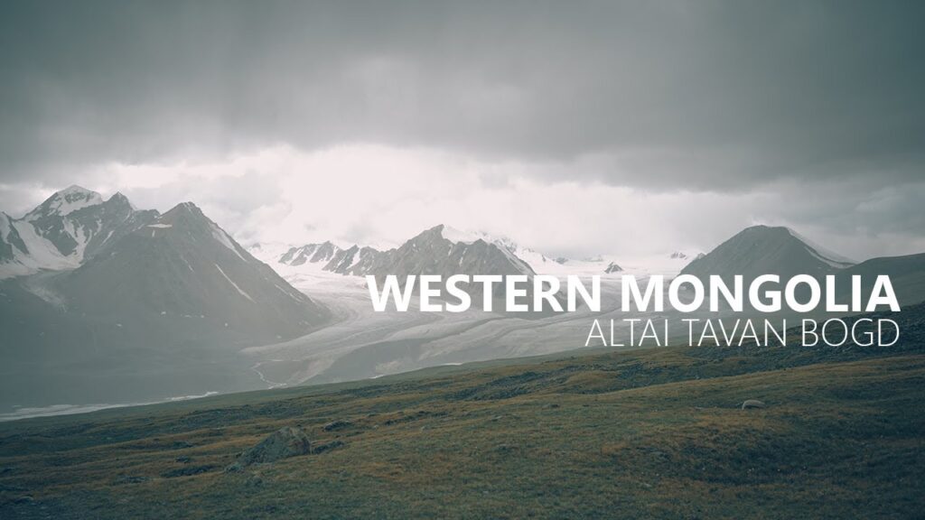
The highest summit is Belukha, reaching 4,506 m (14,783 ft), on the Russia-Kazakhstan border. Mongolia’s section of the range — the Mongolian Altai — culminates in the Tavan Bogd massif, whose highest peak Khüiten reaches 4,374 m.
Unlike young, jagged ranges still in their first phase of uplift, or old, rounded ranges worn down over hundreds of millions of years, the Altai sits in an interesting middle state: ancient crystalline bedrock that has been re-activated and re-lifted by relatively recent tectonic forces. The result is a landscape of hard granite peaks, deep glacial valleys, and active fault lines — geologically complex and still changing.
The Tectonic Story — How the Range Rose
The Altai’s modern shape owes much to a collision happening 2,000 km to the south. The Siberian Altai is described as “the northernmost region affected by the tectonic collision of India into Asia.”
This is the same collision that built the Himalaya. When the Indian tectonic plate drove into the Asian plate — a process that began roughly 50 million years ago and continues today — the force did not stop at the Himalaya. It propagated thousands of kilometres northward, squeezing and uplifting older mountain belts far inland. The Altai is at the far northern edge of that zone of deformation.
What this means in practice: – The crystalline rocks of the Altai are far older than the current mountains — they formed in earlier mountain-building events – The current relief — the height and sharpness of the peaks we see today — is the product of much more recent uplift – The range is being squeezed and lifted along fault zones rather than thrust up as a single block
This is why the Altai feels different from a “simple” range. It is old rock in a young landscape.
The Rock — Granite, Schist, and Fault Zones
Walk any Altai valley and the bedrock tells the story. “Rock types in the mountains are typically granites and metamorphic schists, and some are highly sheared near to fault zones.”
| Rock type | What it is | Where you see it |
|---|---|---|
| Granite | Coarse crystalline igneous rock, cooled slowly deep underground | The hard, pale peaks and domes — including much of the Tavan Bogd massif |
| Metamorphic schist | Layered rock formed by heat and pressure transforming older sediments | Valley walls, foliated cliffs that split along planes |
| Sheared rock | Granite or schist crushed and deformed along fault lines | Near the Kurai and Tashanta fault zones — visibly broken, fractured stone |
Granite is what gives the high Altai its dramatic profile. It is hard, resists erosion, and fractures into clean blocky shapes — producing the sharp ridgelines and steep faces that climbers and trekkers come to see. The metamorphic schist, by contrast, is more easily eroded and tends to underlie the gentler valley slopes.
Where the bedrock has been sheared near fault zones, the rock is weaker and more broken — these zones often become the lines along which rivers and glaciers carve their valleys, because crushed rock erodes faster than solid rock.

A Range That Is Still Moving
The Altai is not a finished, static landscape. It is seismically active.
The mountains are cut by extensive fault systems including the Kurai and Tashanta fault zones, which run through the area “typically as thrusts or right lateral strike-slip faults, some of which are tectonically active.”
The clearest recent demonstration came on 27 September 2003, when a large earthquake measuring magnitude 7.3 occurred in the Chuya Basin area, causing $10.6 million in damage and destroying the village of Beltir.
A magnitude 7.3 earthquake is a major event — it confirms that the faults running through the Altai are not relics but live structures, still accommodating the slow squeeze of continental collision. For visitors this is not a safety concern (large Altai earthquakes are rare and the population density is very low), but it is a reminder that the dramatic landscape exists precisely because the range is geologically young in its current form.
Glaciers, Rivers, and the Shaping of the Peaks
Tectonics built the Altai’s bones; ice and water carved its features.
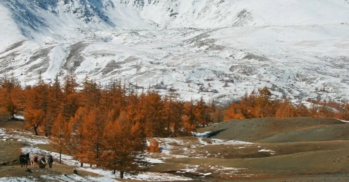
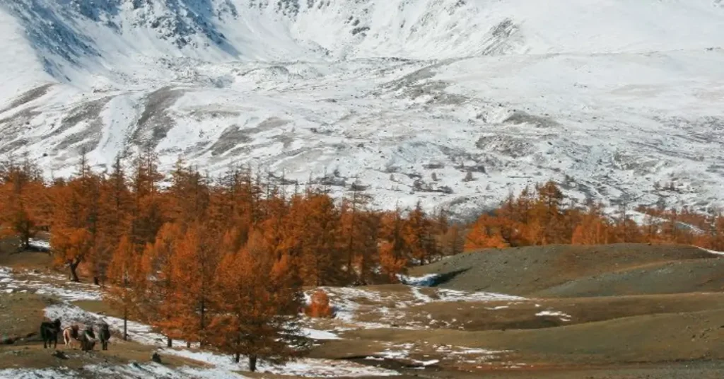
Glaciation: The high Altai carries permanent glaciers, especially around the highest massifs. Belukha alone has several glaciers and glaciokarst formations. The Mongolian Altai’s Tavan Bogd massif holds the Potanin Glacier — Mongolia’s longest — and the Alexandra Glacier. Glaciers grind down valley floors, pluck rock from cliff faces, and leave behind the classic U-shaped valleys, moraine ridges, and glacial lakes that define high-Altai scenery.
Rivers: The Altai is a major water tower for Inner Asia. The rivers Irtysh and Ob have their headwaters in these mountains. The Ob-Irtysh is one of the longest river systems in the world, and its existence depends on Altai snowmelt and glacial melt. Within Mongolia, the meltwater feeds the Khovd River and the lake systems of the western basins.
The interplay is what produces the landscape trekkers experience: hard granite peaks shaped by tectonic uplift, then sculpted by ice into ridges and cirques, then drained by fast meltwater rivers that cut deep gorges through the softer rock.
What the Geology Means for Trekkers
The Altai’s geology is not just an academic story — it shapes the practical experience of a trek:
- Footing: Granite gives solid, reliable footing on ridges and slabs. Sheared rock near fault zones is loose and broken — your guide will route around the worst of it.
- Water: Glacier-fed rivers run cold, fast, and often milky-grey with “rock flour” (finely ground rock). River crossings are timed for early morning when meltwater volume is lowest.
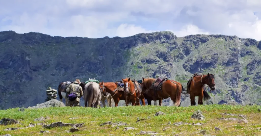
- Valley shapes: The classic U-shaped glacial valleys make for relatively gentle valley-floor walking; the steep granite headwalls are what require the climbing skills on peaks like Khüiten and Malchin.
- The peaks themselves: The dramatic, photogenic sharp summits exist because granite resists erosion. The Tavan Bogd “Five Saints” massif is essentially a great granite block sculpted by ice.
- Seismic landscape features: Some valley alignments and lake basins follow old fault lines — a guide who knows the geology can point out where the landscape itself records the faults.
For travellers who want to read the landscape as they walk it, an Altai trek becomes far richer with this background. The 6-Day Best Of Altai Tavan Bogd tour and the 11-Day Mongolia Trekking Tour both travel through the granite high country of the Tavan Bogd massif, and our guides can explain the rock, the glaciers, and the faults as you go. For the bigger picture of where to walk, see our Altai Tavan Bogd trekking routes overview.
Suggested Tours:
Suggested Blogs:
Self-Guided vs Guided Motorcycle Tour in Mongolia: Which One Actually Fits Your Ride?
For roughly 85% of international riders, a fully-guided Mongolia motorcycle tour is the right format — the supported package costs…Mongolia Motorcycle Packing List 2026: What You Actually Need for the Altai
A 10-day Mongolia motorcycle tour packing list comes down to five layers of gear: serious riding kit (full helmet, armoured…Mongolia Motorcycle Tour Cost in 2026: What You’ll Actually Pay (and What’s Included)
A guided 10-day Mongolia motorcycle tour costs around $3,600 per person in 2026 when booked through a licensed local operator…


How were the Altai Mountains formed?
The Altai’s crystalline bedrock — granite and metamorphic schist — formed in ancient mountain-building events. The range’s current height and sharp relief are the result of much more recent uplift, driven by the distant collision of the Indian tectonic plate into Asia. The Siberian Altai is the northernmost region still affected by that collision. The mountains are squeezed and lifted along active fault zones rather than thrust up as a single block.
What is the Altai Mountains made of?
The bedrock is mainly granite (a hard crystalline igneous rock) and metamorphic schist (a layered rock formed by heat and pressure). Near the major fault zones the rock is highly sheared — crushed and fractured. Granite forms the dramatic high peaks; schist underlies the gentler valley slopes.
How high are the Altai Mountains?
The highest summit of the entire Altai range is Belukha at 4,506 m (14,783 ft), on the Russia-Kazakhstan border. Mongolia’s section culminates in the Tavan Bogd massif, with Khüiten Peak reaching 4,374 m — the highest point in Mongolia.
Are the Altai Mountains still growing?
Yes, in the geological sense. The range sits in a tectonically active zone with live fault systems including the Kurai and Tashanta fault zones. A magnitude 7.3 earthquake struck the Chuya Basin in 2003, confirming the faults are still accommodating tectonic stress. The mountains are slowly being lifted and reshaped, though far too slowly to notice in a human lifetime.
How long is the Altai mountain range?
The Altai Mountains stretch for 2,525 km (1,569 miles) from northwest to southeast, crossing the borders of four countries — Russia, China, Mongolia, and Kazakhstan. The Mongolian Altai is the southeastern section, including Altai Tavan Bogd National Park.
Is it safe to trek in a seismically active range?
Yes. Large Altai earthquakes are rare events spaced decades apart, and the region’s population density is extremely low. The 2003 Chuya earthquake was a notable event precisely because such large quakes are uncommon. Standard trekking risks in the Altai — weather, altitude, river crossings — are far more relevant to plan for than seismic activity.