Khüiten Peak, also known as Mount Khüiten, is the highest point in Mongolia. It is situated in the far west of the country, on the border with Russia, at the foot of Mount Tavan Bogd.
Khüiten Peak is 4,374 metres (14,350 ft) high and is the highest mountain in the Mongolian Altai mountain range. The chain of 5 mountains in the country represent 5 saints, and each mountain is named for a different saint:
- Khuiten meaning “cold”,
- Burged meaning “the eagle”,
- Olgii meaning “cradle”,
- Malchin meaning “the herder”
- Nairamdal meaning “friendship”.
Khüiten Peak: Mongolia’s Highest Point Explained
Khüiten Peak rises to 4,374 metres (14,350 feet) at the westernmost tip of Mongolia, making it the country’s highest point.
The peak is also known as “Nayramadlyn Orgil” (Friendship Peak) in Mongolian or “Hüyten Peak” in older transliterations — all refer to the same summit.
Khüiten sits exactly at the tri-border point where Mongolia, Russia, and China meet, giving it strategic geographic significance beyond elevation alone.
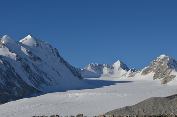
The peak is part of the Tavan Bogd massif (“Five Saints” in Mongolian), a cluster of five peaks that includes Khüiten alongside Naran, Olgii, Burged, and Malchin.
Khüiten lies inside Altai Tavan Bogd National Park in Bayan-Ölgii Province, western Mongolia — a protected area covering roughly 6,362 km² of glaciated mountains, alpine lakes, and Kazakh nomadic territory.
Mongolia’s Top 5 Highest Peaks (Tavan Bogd Massif)
The five peaks of the Tavan Bogd massif sit on the Mongolia–China border in Bayan-Ölgii Province and form the country’s highest cluster of summits.
Khüiten Peak (4,374 m / 14,350 ft) — Mongolia’s highest, technical glacier ascent, climbed June–August.
Naran Peak (~4,300 m / ~14,108 ft) — the second-highest peak of the Tavan Bogd, rarely climbed.
Olgii Peak (~4,050 m / ~13,287 ft) — accessible from the Potanin Glacier route.
Burged Peak (~4,068 m / ~13,346 ft) — flanks the eastern Tavan Bogd.
Malchin Peak (4,050 m / 13,287 ft) — non-technical summit popular with trekkers; the most-climbed peak in the Tavan Bogd group.
Geography: How the Mongolian Altai Connects to the Gobi Altai
From Khüiten Peak, the Mongolian Altai (Mongol Altayn Nuruu) extends southeast and then east across western Mongolia.
The Mongolian Altai gradually transitions into the Gobi Altai Mountains (Govi Altain Nuruu) — a lesser range of denuded hills that lose themselves in the Gobi Desert expanses.
The greater Altai mountain system spans the convergence of four countries — Mongolia, Russia, China, and Kazakhstan — and is recognized by UNESCO for its biodiversity (the Russian-side “Golden Mountains of Altai” is a UNESCO World Heritage Site).
Beyond the Tavan Bogd cluster, Mongolia’s highest single peak outside the Altai is Otgontenger (4,008 m / 13,150 ft) in the Khangai Mountains — a sacred site for Buddhist Mongolians.
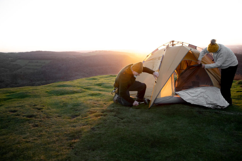
Getting to the Highest Point in Mongolia
The journey from Ulaanbaatar to Khüiten Peak base camp typically takes 3 days — a 2.5-hour domestic flight to Ölgii (Bayan-Ölgii’s provincial capital), followed by a 6–8 hour 4×4 drive to a trailhead, then a 1–2 day approach by horse or trekking to the Potanin Glacier base camp.
Climbing permits are required — the area sits within Altai Tavan Bogd National Park AND inside the Mongolia–China–Russia border zone. Both park entry and border-zone permits must be arranged in advance through a licensed Mongolian operator.
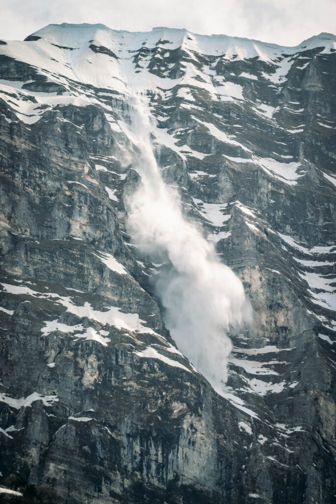
The standard climbing window is mid-June to mid-August, when high-altitude passes are snow-free and the Potanin Glacier is most stable. Outside this window, the mountain is closed by snow, extreme cold, and avalanche risk.
Independent climbers without a licensed Mongolian operator cannot legally access Khüiten Peak — the border-zone permit can only be issued through accredited tour companies.
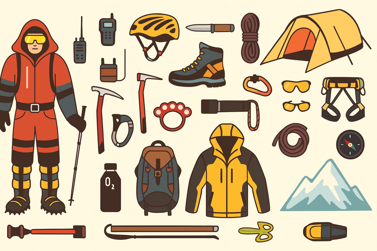
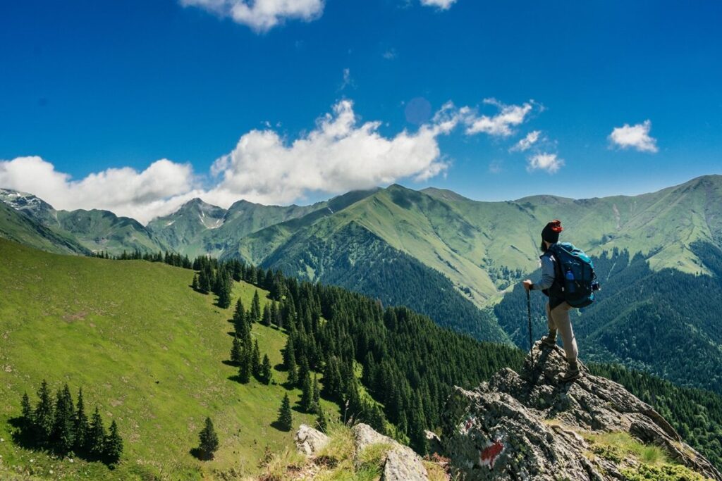
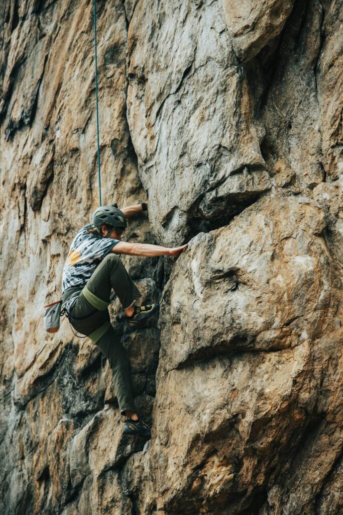
Climbing Khüiten Peak: What to Expect
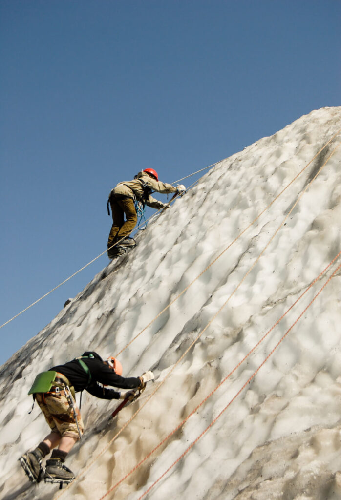
Khüiten is a moderate-to-challenging mountaineering objective — the standard route requires crampons, ice axe, harness, and rope-team travel across the Potanin Glacier, but it is non-technical compared to Himalayan peaks.
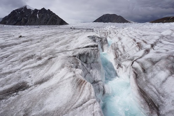
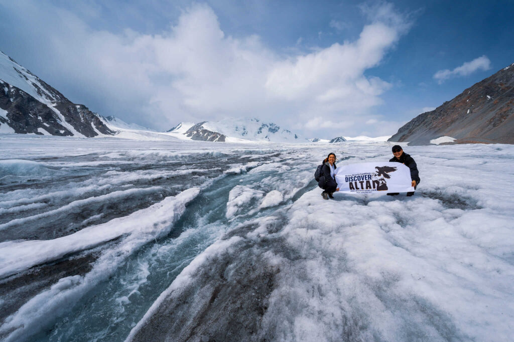
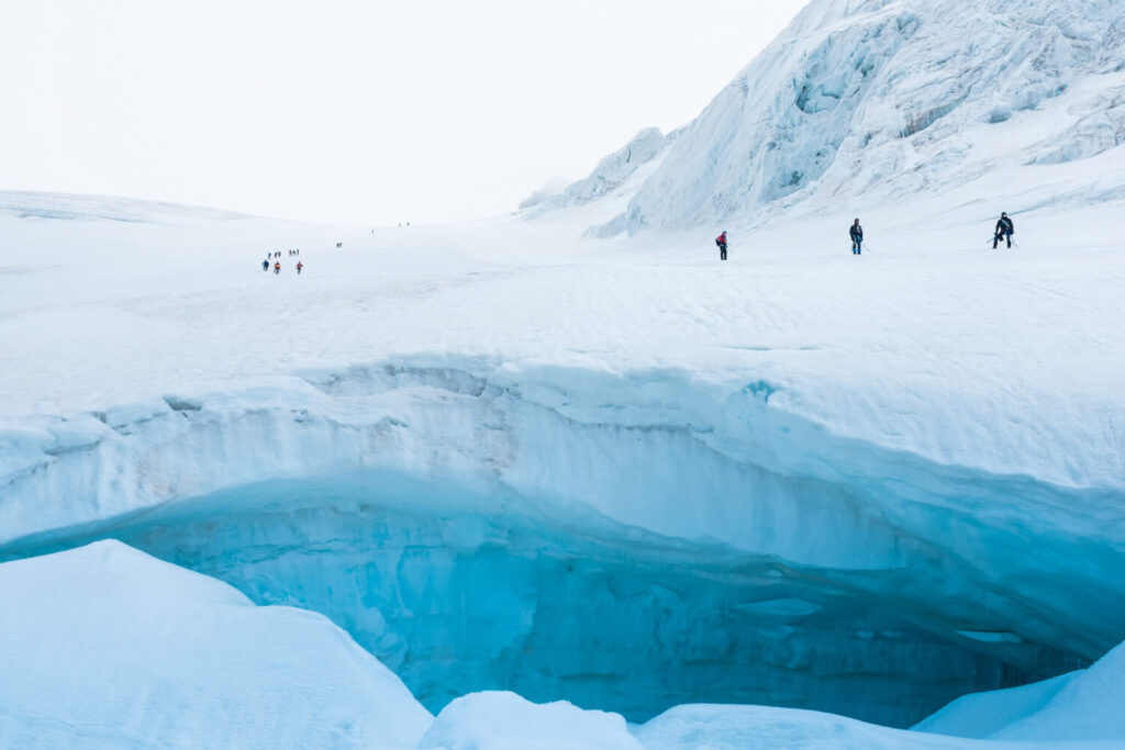
The Potanin Glacier, named after Russian explorer Grigory Potanin who mapped the area in the 1870s, is the largest glacier in Mongolia and forms the standard base-camp approach for the Khüiten ascent.
Summit-day altitude exceeds 4,300 m, where mild altitude sickness affects roughly 25–40% of climbers. Acclimatization at base camp (3,200 m) for 1–2 days before the summit attempt is standard practice.
Approximately 70% of fit, properly equipped climbers reach the Khüiten summit on their first attempt; weather is the most common reason for unsuccessful attempts.
A typical expedition runs 8–10 days door-to-door from Ulaanbaatar, with summit day requiring 8–12 hours of climbing from high camp.
We offer you CLIMB MOUNT KHUITEN MONGOLIA. Mount Khuiten is the highest peak in Mongolia, which is located in the remote area of the Mongolian Altai region. It will be wonderful 🤩🤩
WHAT CAN YOU SEE THERE?
🌏 Want to experience this in person? Join our Browse all Mongolia tours with local Kazakh guides — small groups, authentic experience, 5.0 stars on TripAdvisor.
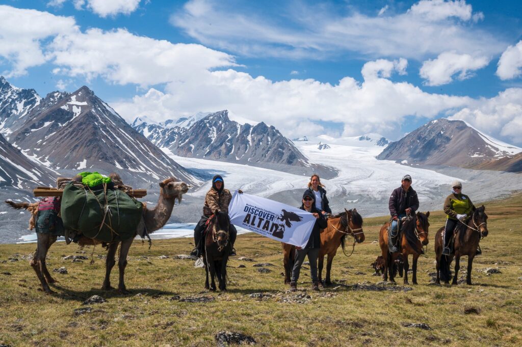
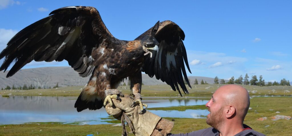
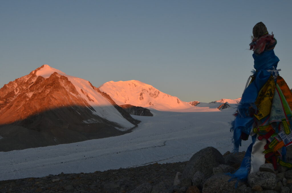
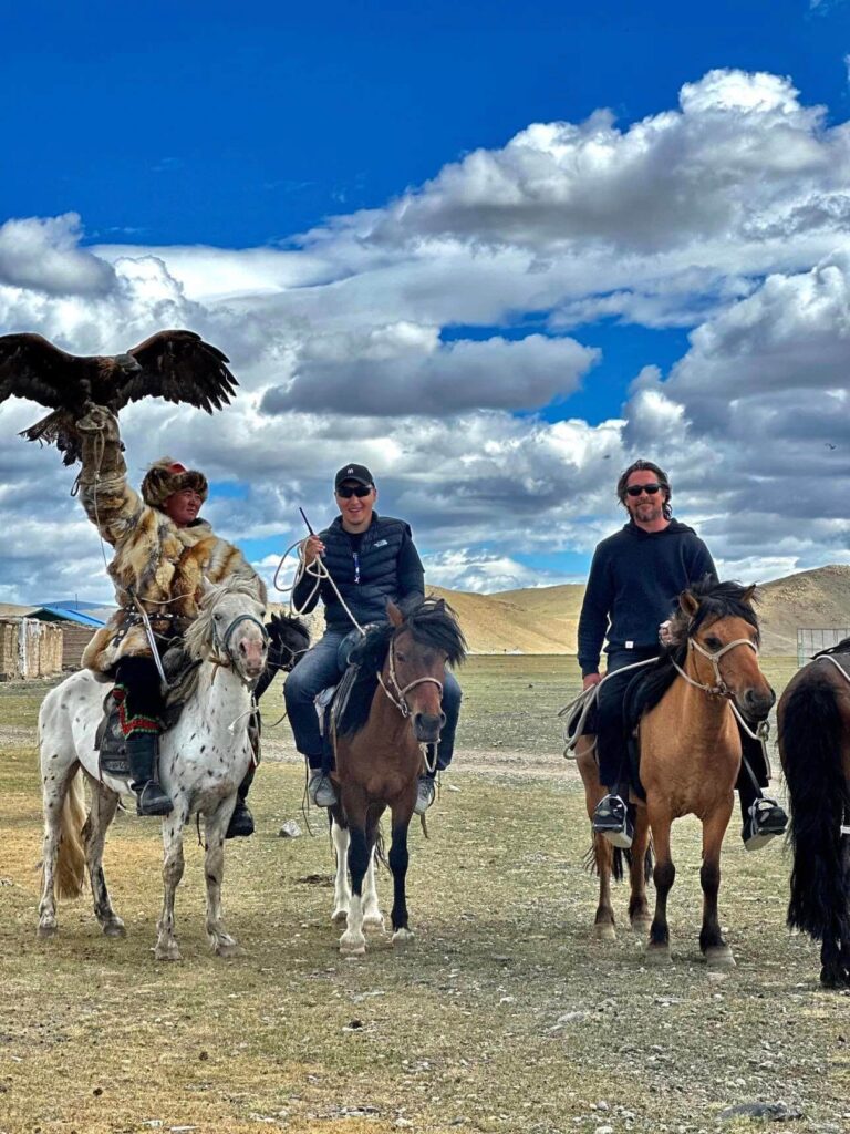
The magnificent peak of Khuiten is protected by Altai Tavan Bogd National Park, a haven of breathtaking beauty. Glaciated peaks, turquoise lakes, and enormous grass-covered vallies inhabited by Kazakh herders and eagle hunters make for a panorama that is spellbinding.
Lower down the hill, you may spot animals including lynxes, foxes, and eagles. Some green pastures are also available lower down the hill. This peak is unique in every respect because it experiences sub-zero temperatures all year.
The region is also rich in archeological sites; in fact, many examples of prehistoric man have been discovered nearby. The area boasts a high number of yeti sightings too; one trip report even claims that climbers spotted tracks while en route to climb Mt. Snow Church, which is just one valley over from Khüiten.
CLIMBING THE HIGHEST POINT IN MONGOLIA
Mongolian mountaineers climbed Khuiten Peak in 1956. In 2013, the National Geographic Society ranked it as one of the world’s top ten dangerous climbs.
Situated in a remote location with treacherous terrain, Khüiten Peak is one of the most difficult mountains to climb in Mongolia. Despite this, it remains a popular destination for mountaineers and hikers alike. The first successful ascent was made by a Japanese expedition in 1938.
Mongolia’s biggest glacier, Potanine, is highly visible from the peak, as are other summits located in Russia and China.
The climb to the top isn’t challenging by mountaineering standards, but rather it’s the journey through this remote and remarkable place that attracts most visitors. The ideal time to climb is between June and August.
Getting There
Starting Point – Ulaanbaatar
- Your journey to Khüiten Peak begins in Mongolia’s capital, Ulaanbaatar, which is well-connected internationally by air. Flights from major cities such as Beijing, Seoul, Istanbul, and Tokyo are available.
Travel to Ölgii
- From Ulaanbaatar, take a domestic flight to Ölgii, the capital of Bayan-Ölgii Province. The flight takes around 3 hours and is the fastest and most convenient way to reach this remote region. Alternatively, adventurous travelers can opt for a multi-day overland journey by car or bus, though this is time-consuming and challenging.
Drive to Altai Tavan Bogd National Park
- From Ölgii, hire a 4×4 vehicle to drive approximately 200 kilometers (125 miles) to the Altai Tavan Bogd National Park. The drive takes 5-6 hours and involves crossing rugged terrain, passing through beautiful valleys, and visiting nomadic settlements.
Trek to Base Camp
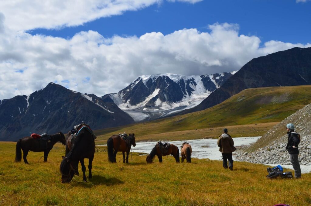
- The road ends at a trailhead near the Tavan Bogd ranger station. From here, you’ll begin a 15-18 kilometer (9-11 mile) trek to the base camp. Horses can be rented to carry supplies, and local guides are often available to assist.
The Climbing Route to Khüiten Peak
- Base Camp
- The Base Camp is located at approximately 3,200 meters (10,500 feet), situated near the Potanin Glacier. It offers stunning views of the surrounding peaks and serves as the starting point for climbing Khüiten.
- Glacier Crossing
- The route to Khüiten Peak involves traversing the Potanin Glacier, which requires proper glacier trekking gear such as crampons, harnesses, and ice axes. The terrain is icy and crevassed, so a guide is highly recommended for safety.
- High Camp
- Many climbers establish a High Camp at around 3,800 meters (12,500 feet) to break up the ascent. This reduces altitude sickness risk and allows for acclimatization before the summit push.
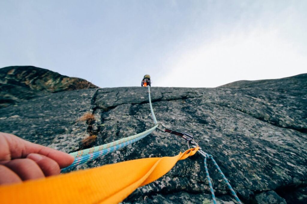
- Summit Push
- The climb from High Camp to the summit takes about 6-8 hours. The ascent includes steep snow and ice slopes with gradients of 30-45 degrees, requiring technical climbing skills. Roped sections are necessary due to potential falls and crevasse dangers.
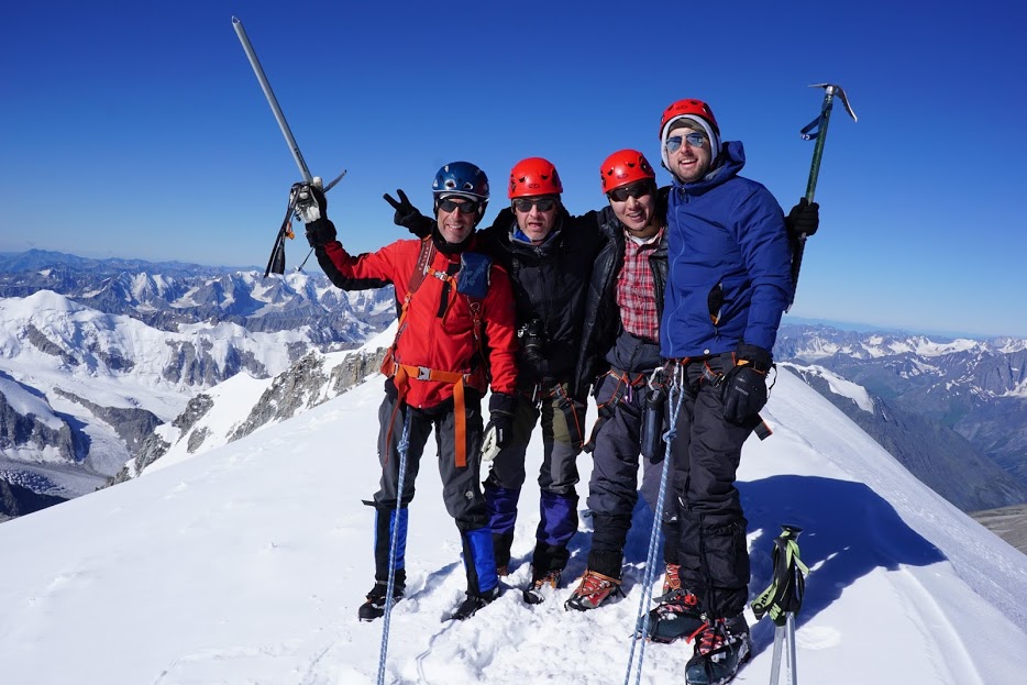
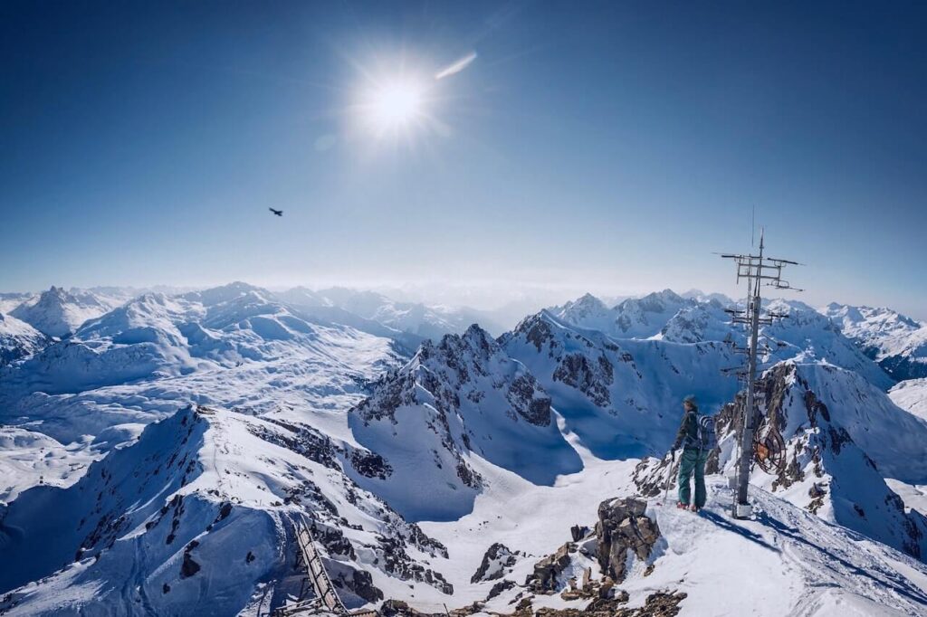
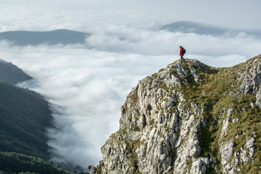
- The Summit
- Upon reaching the summit at 4,374 meters (14,350 feet), climbers are rewarded with breathtaking panoramic views of Mongolia, China, and Russia. The feeling of standing on the roof of Mongolia is unforgettable!
- Descent
- The descent typically follows the same route and takes 4-6 hours. Climbers usually return to High Camp or directly to Base Camp, depending on time and weather conditions.
The Altai mountain region is a pristine example of what the world looked like during the last glacial period, which ended around 11,000 years ago. Khüiten Peak is a window into that world, and climbing it is an opportunity to feel like you’ve stepped back in time. So don’t miss out on this chance.
Suggested Tours:
Mongolia Altai Mountain Tour 2026 — 8 Days: Peak Climb + Culture + Nomadic Stay | $1,700
Unleash your adventure spirit, explore Mongolia on your own terms MONGOLIA ALTAI MOUNTAIN TOUR ⭐⭐⭐⭐⭐ 5.0 · 63 reviews on…MONGOLIAN NOMAD MIGRATION TOUR
Unleash your adventure spirit, explore Mongolia on your own terms Mongolian Nomad Migration tour ⭐⭐⭐⭐⭐ 5.0 · 63 reviews on…Mongolia Trekking Tour 2026 — 11-Day Altai Tavan Bogd Trek from $2,000
Unleash your adventure spirit, explore Mongolia on your own terms ALTAI TREKKING TOUR IN MONGOLIA By Dauren, Bayan-Olgii local guide since…
Related Blogs:
Mountain Rescue in Mongolia: How It Works, Emergency Contacts, and Why You Need Insurance
Mountain rescue in Mongolia is limited and self-organised. There is no national equivalent of the Swiss Air-Glaciers, French PGHM, or…Khüiten Peak Climbing Season: Best Months, Weather Windows, and Why Most Climbs Happen in July–August
The Khüiten Peak climbing season runs from late June to mid-September, with July and August as the prime climbing months…Mountain Climbing Risks: Exploring the Challenges and Safety Measures
Mountain Climbing Risks: Exploring the Challenges and Safety Measures – Mountain climbing is an exhilarating and adventurous activity that has…


How tall is the highest point in Mongolia?
Mongolia’s highest point is Khüiten Peak (also called Nayramadlyn Orgil) at 4,374 metres (14,350 feet), located at the westernmost tip of the country in Bayan-Ölgii Province where Mongolia, Russia, and China meet.
What is the difference between Khüiten Peak and Tavan Bogd?
Khüiten Peak is the highest single summit in Mongolia (4,374 m). The Tavan Bogd massif (“Five Saints”) is the cluster of FIVE peaks that contains Khüiten, plus Naran, Olgii, Burged, and Malchin. The whole cluster lies inside Altai Tavan Bogd National Park in Bayan-Ölgii Province.
When is the best time to climb the highest point in Mongolia?
The climbing season for Khüiten Peak runs mid-June to mid-August. July offers the most stable summit weather; mid-August has the lowest river-crossing levels. Outside June–August, the high passes close due to snow and the mountain becomes inaccessible to non-expedition climbers.
Do you need a permit to climb Mongolia’s highest peak?
Yes — two permits are required because Khüiten Peak sits inside Altai Tavan Bogd National Park AND inside the Mongolia–China–Russia border zone. Both permits must be arranged in advance through a licensed Mongolian tour operator; independent climbers cannot legally access the climb.
How does Khüiten Peak compare to other highest mountains in Asia?
At 4,374 m, Khüiten Peak is far below the giants of the Himalayas (Everest at 8,849 m) and the Pamirs (Ismoil Somoni Peak at 7,495 m), but it is comparable to the highest peaks of Central Asian sub-ranges like the Tian Shan’s Mount Belukha (4,506 m, in Russia’s Altai). Within Mongolia, the next-highest peak outside the Tavan Bogd is Otgontenger (4,008 m) in the Khangai Mountains.